April 1st, 2025
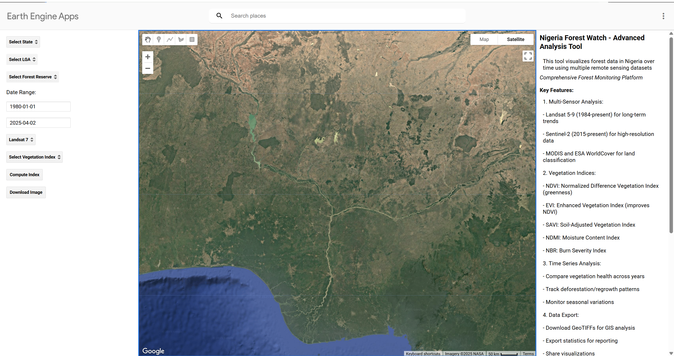
Nigeria Forest Watch
Visualize and analyze forest data in Nigeria using remote sensing datasets and various forest-related indices.
View ProjectExplore my complete portfolio of API Development, data science, GIS, and engineering work
Visualize and analyze forest data in Nigeria using remote sensing datasets and various forest-related indices.
View Project
Monitor agricultural lands using satellite imagery, computing vegetation indices like NDVI and NDMI.
View Project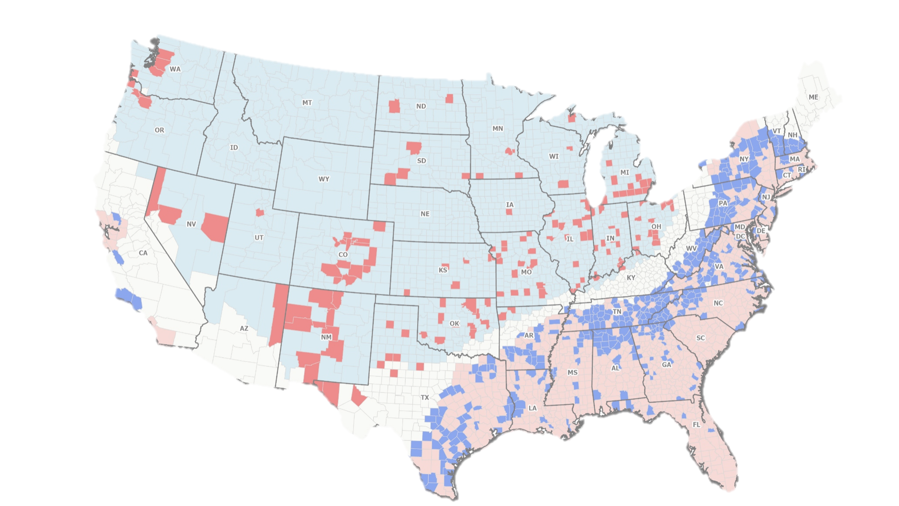
Spatial statistical analysis of HIV prevalence patterns across the United States with socio-demographic factors.
View Project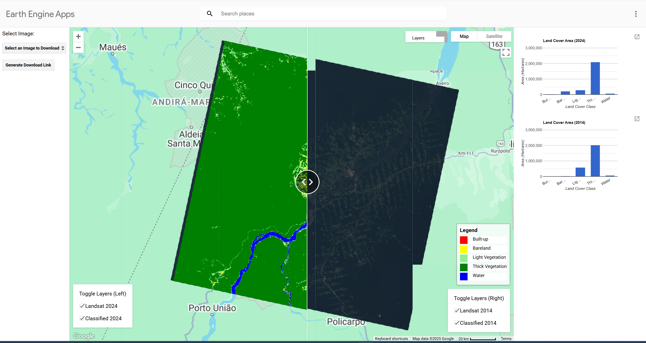
GEE app to visualize and analyze land use changes in the Amazon, exploring deforestation trends.
View Project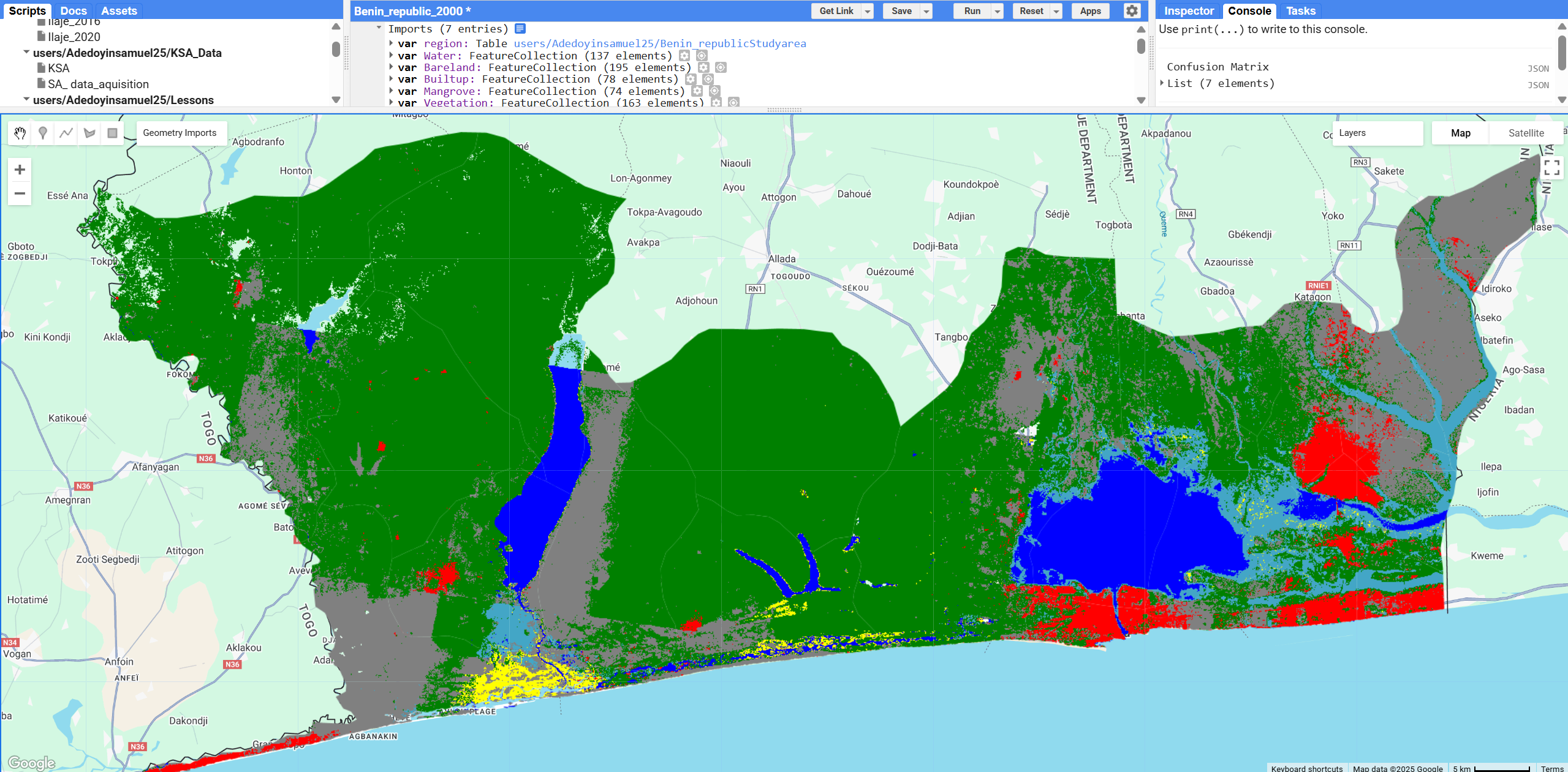
Machine learning classification of mangroves and land use in Benin Republic achieving 90%+ accuracy.
View Project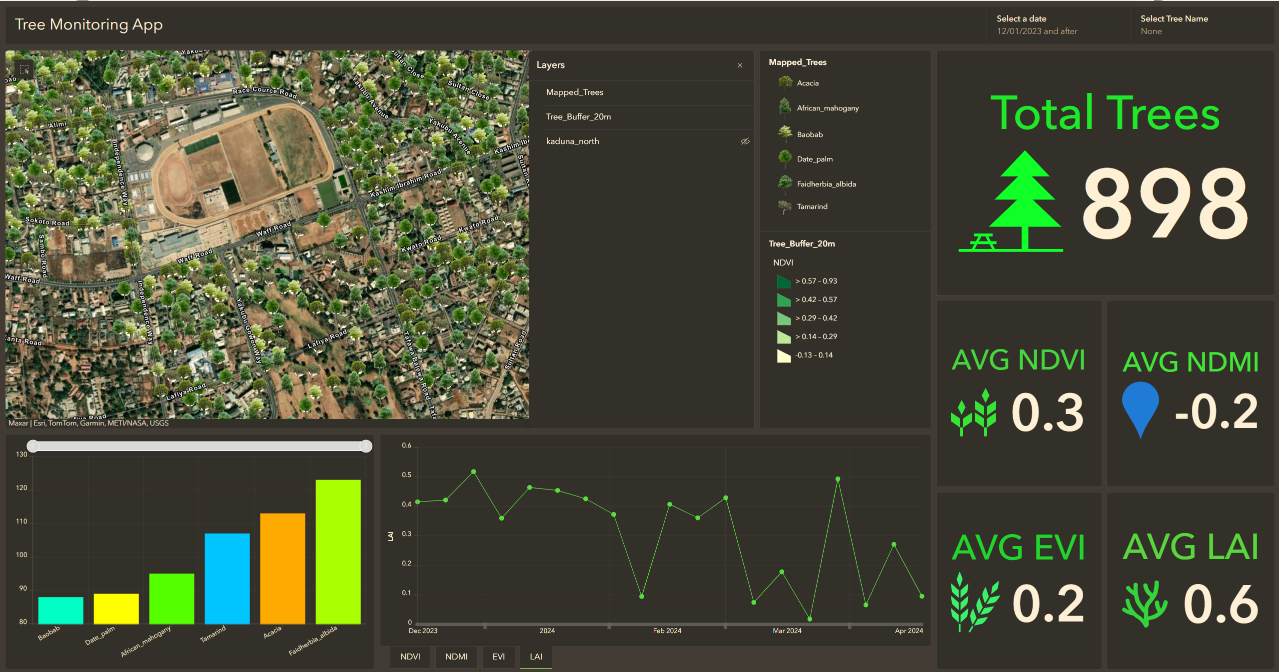
Automated geospatial pipeline using ArcGIS and Earth Engine for tree health monitoring.
View Project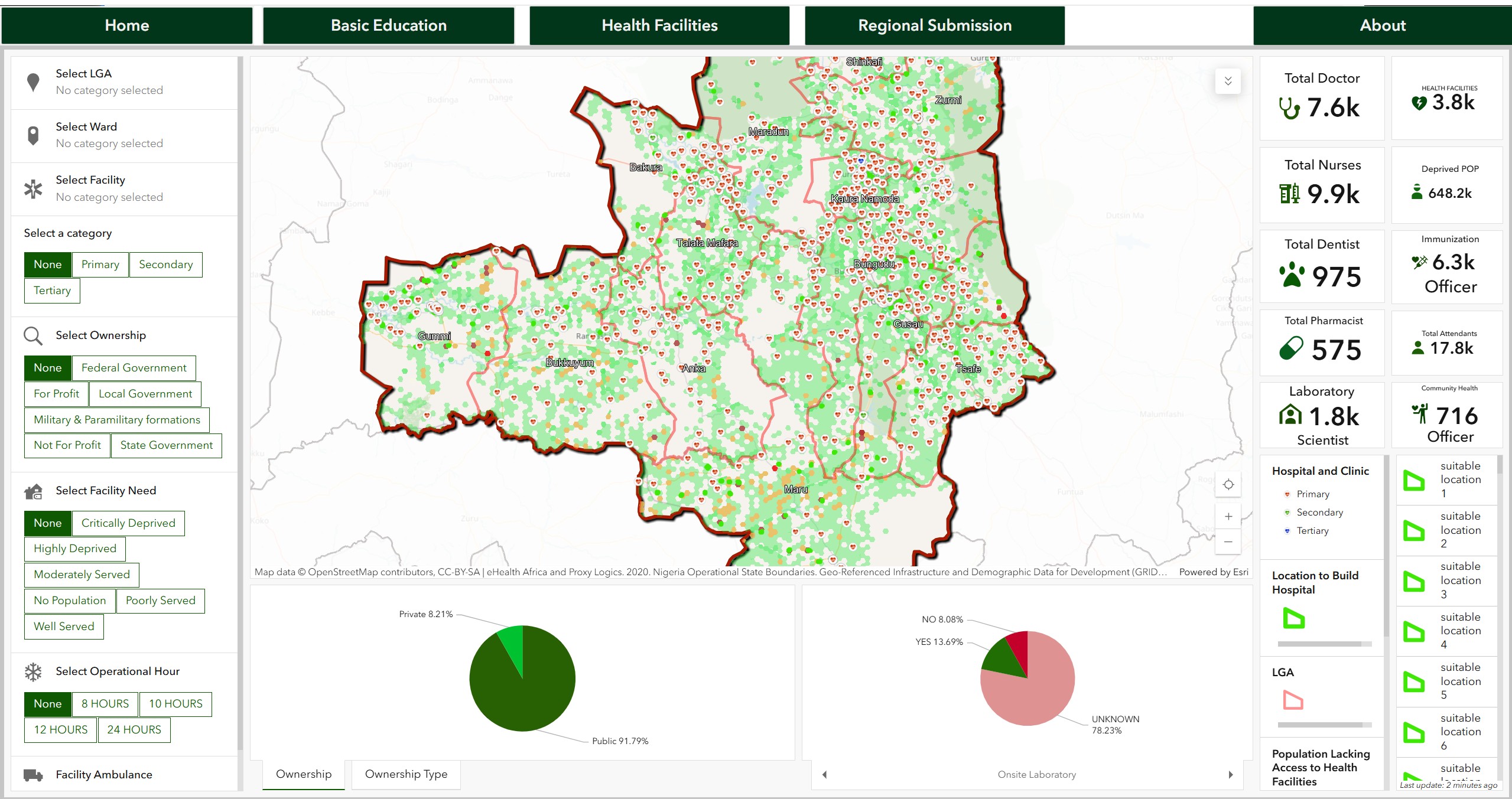
GIS analysis of education and healthcare accessibility in Zamfara State, Nigeria.
View Project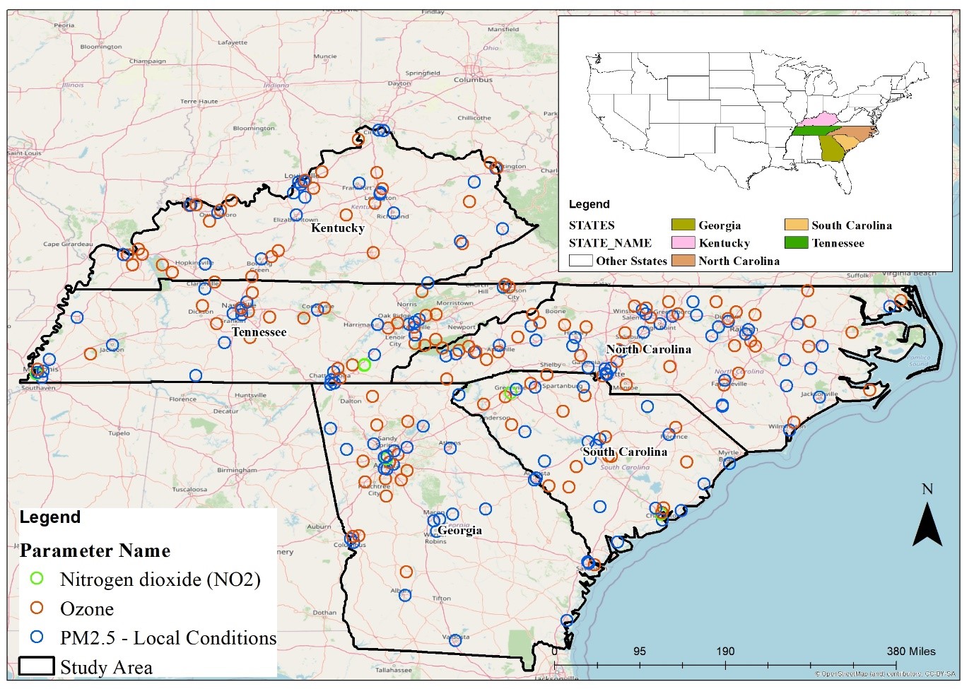
EPA monitoring station data analysis to model Ozone, Nitrogen, and PM2.5 distribution using R Spatial.
View Project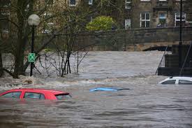
Machine learning model predicting flood likelihood based on topographical and environmental factors.
View Project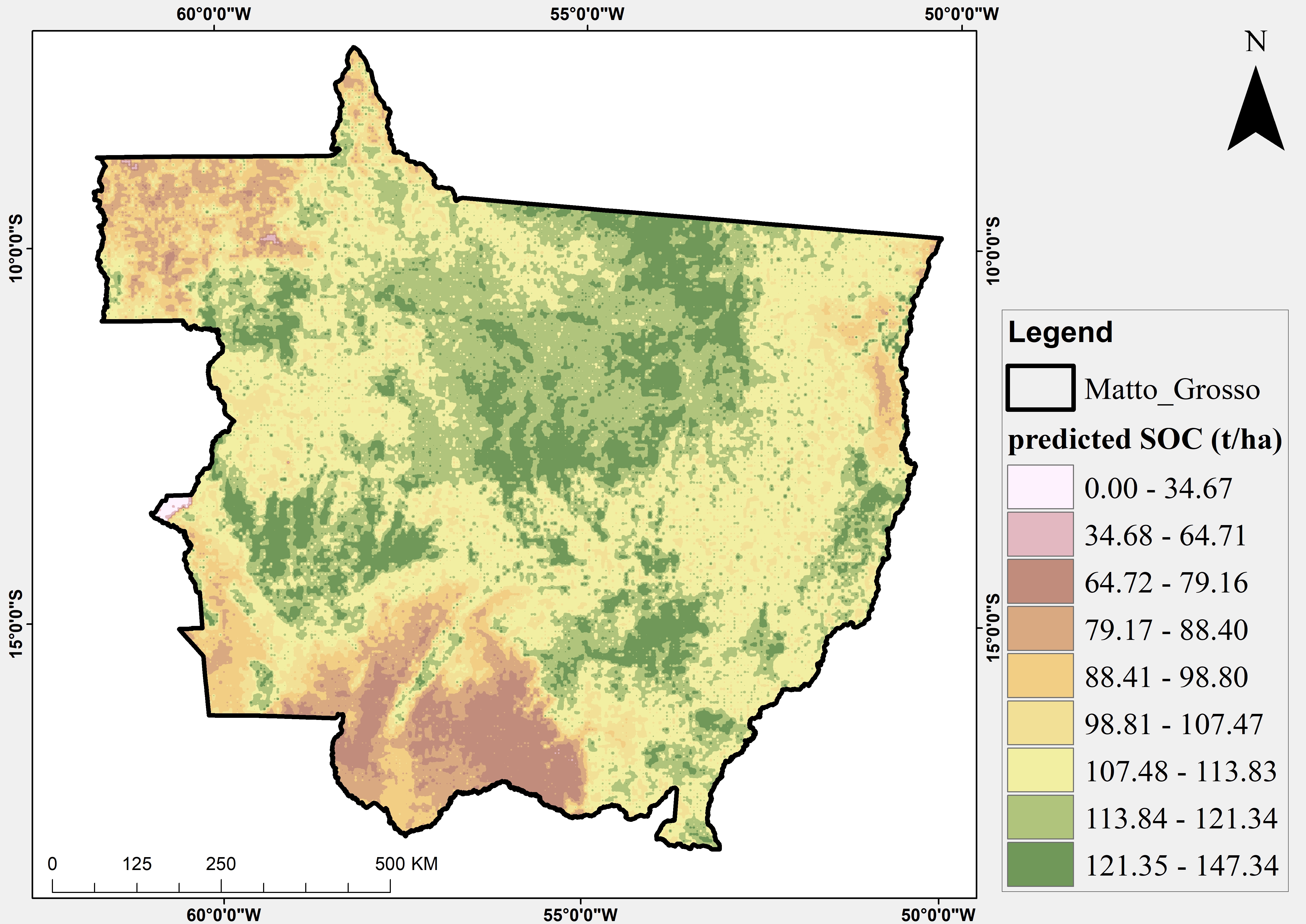
Spatial modeling framework for predicting SOC concentrations in Mato Grosso, Brazil using ML.
View Project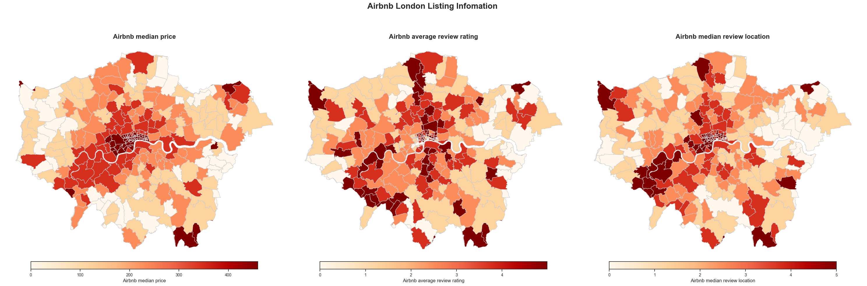
Spatial analysis of Airbnb listings and housing market dynamics in London using advanced techniques.
View Project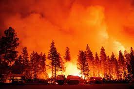
Analysis of the 2022 Mosquito Fire in California using satellite imagery and Geemap.
View Project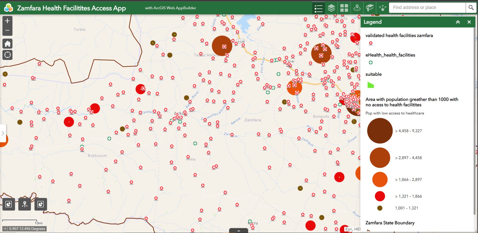
WebGIS platform measuring healthcare accessibility and identifying optimal locations for new facilities.
View Project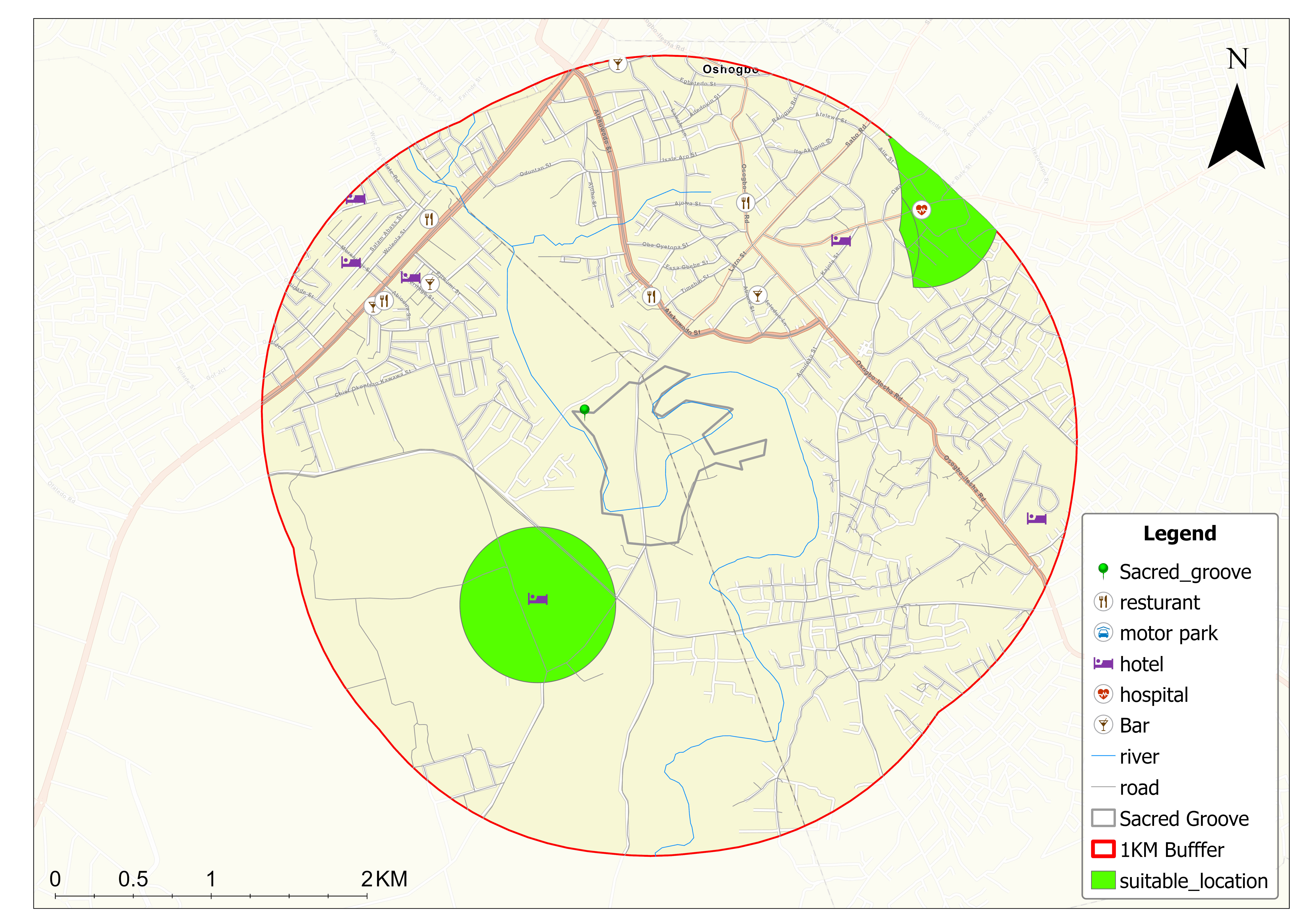
Location intelligence analysis to find the perfect restaurant spot near Osun-Osogbo Sacred Grove.
View Project
I designed, built, and deployed a complete API endpoint that allows Property Owners and Real Estate Professionals to instantly understand the Climate Risk associated with the land or properties they are considering purchasing.
View Project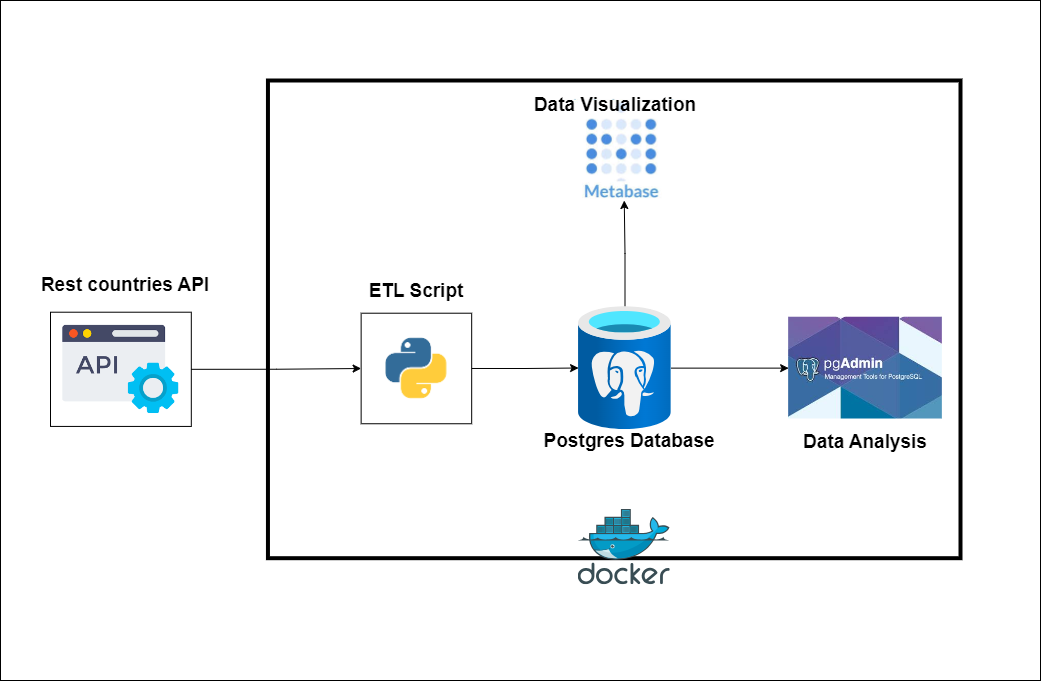
Scalable data pipeline extracting country data from APIs, transforming and visualizing in Metabase.
View Project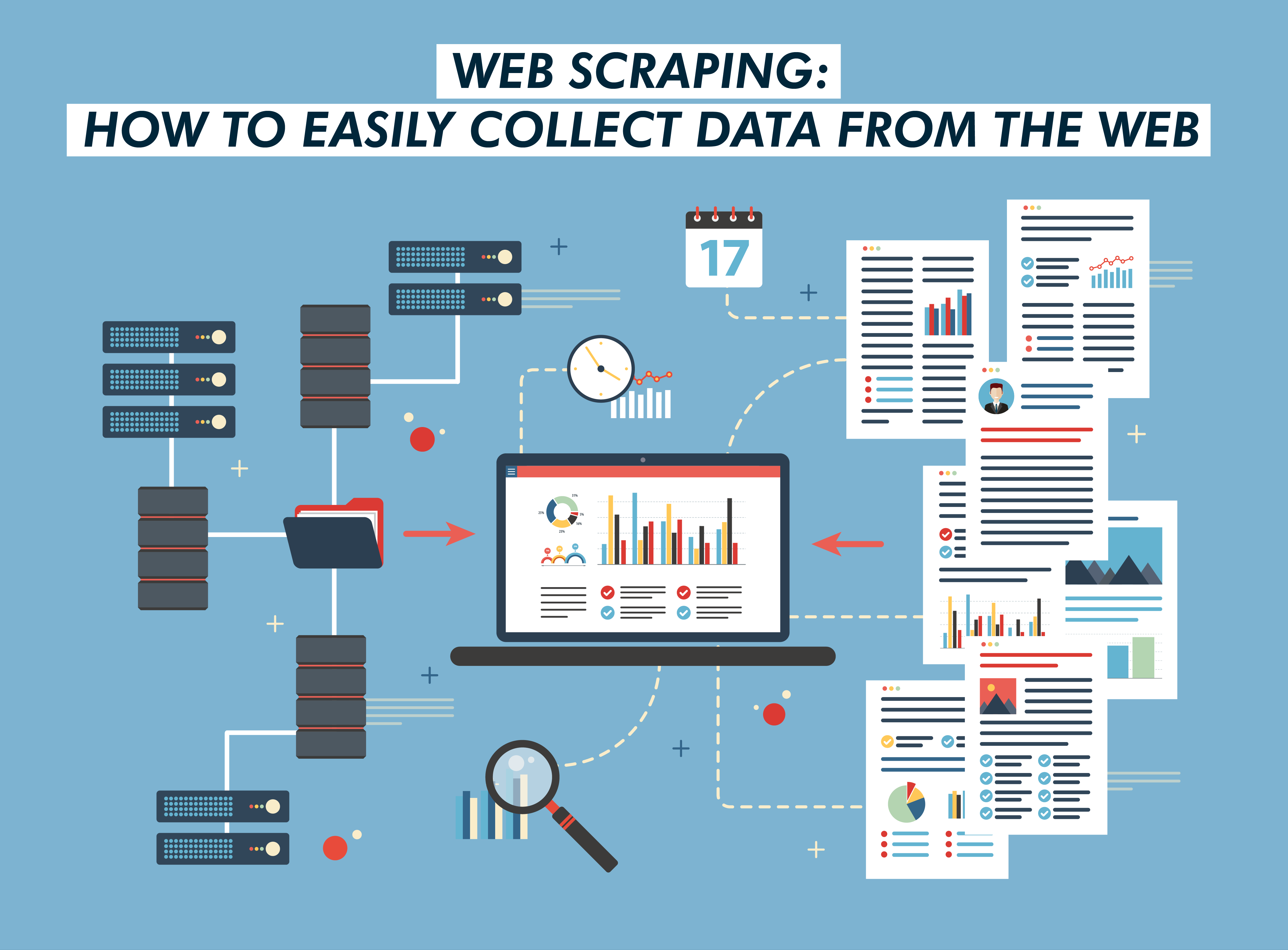
Automated scraping of YouTube trending videos using Selenium and AWS Lambda.
View Project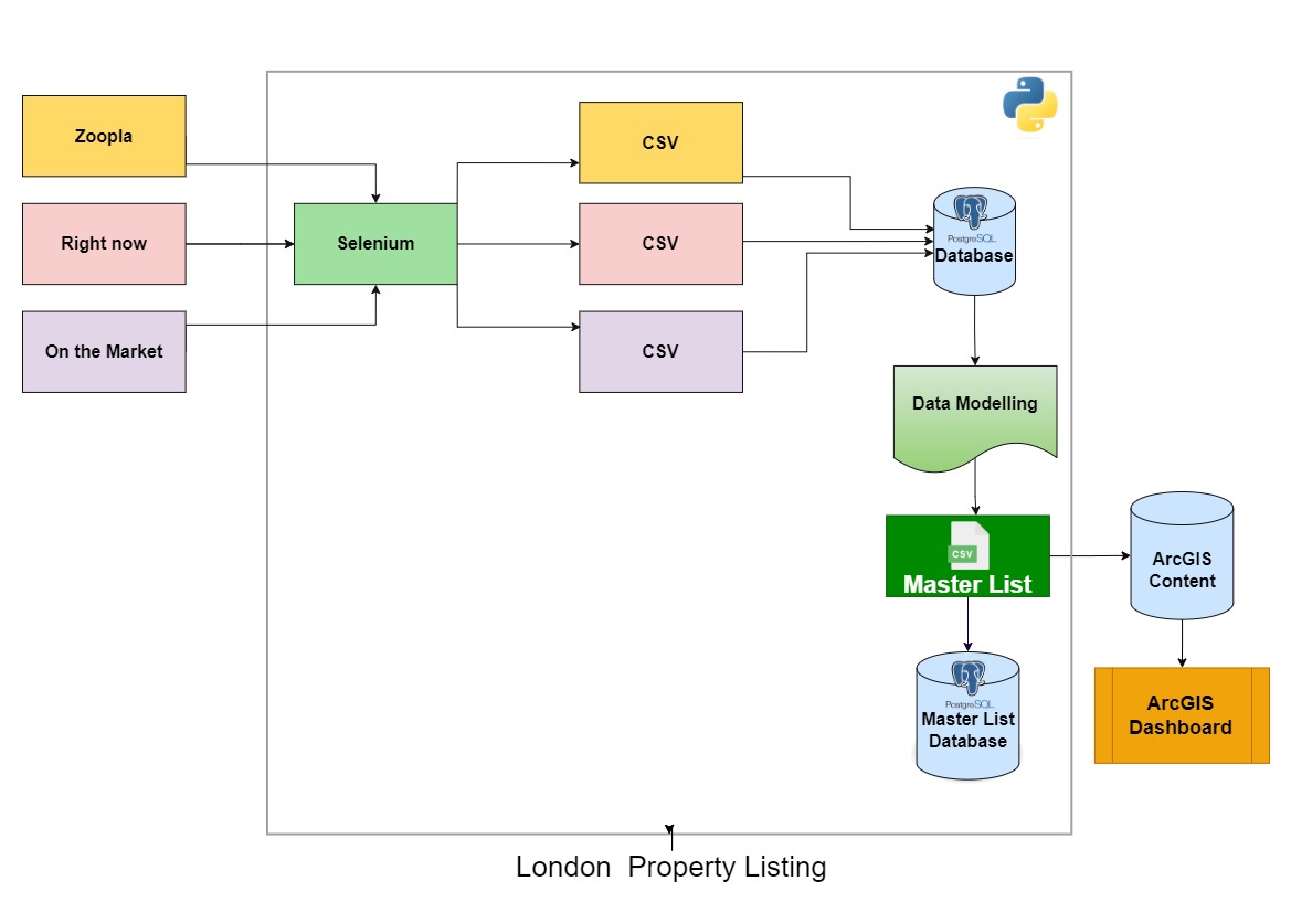
Extract and blend property datasets across Greater London into one comprehensive master list.
View Project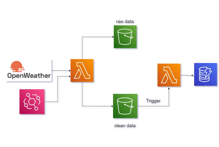
AWS-based system using Lambda, S3, EventBridge, and DynamoDB to collect weather data for Lagos.
View Project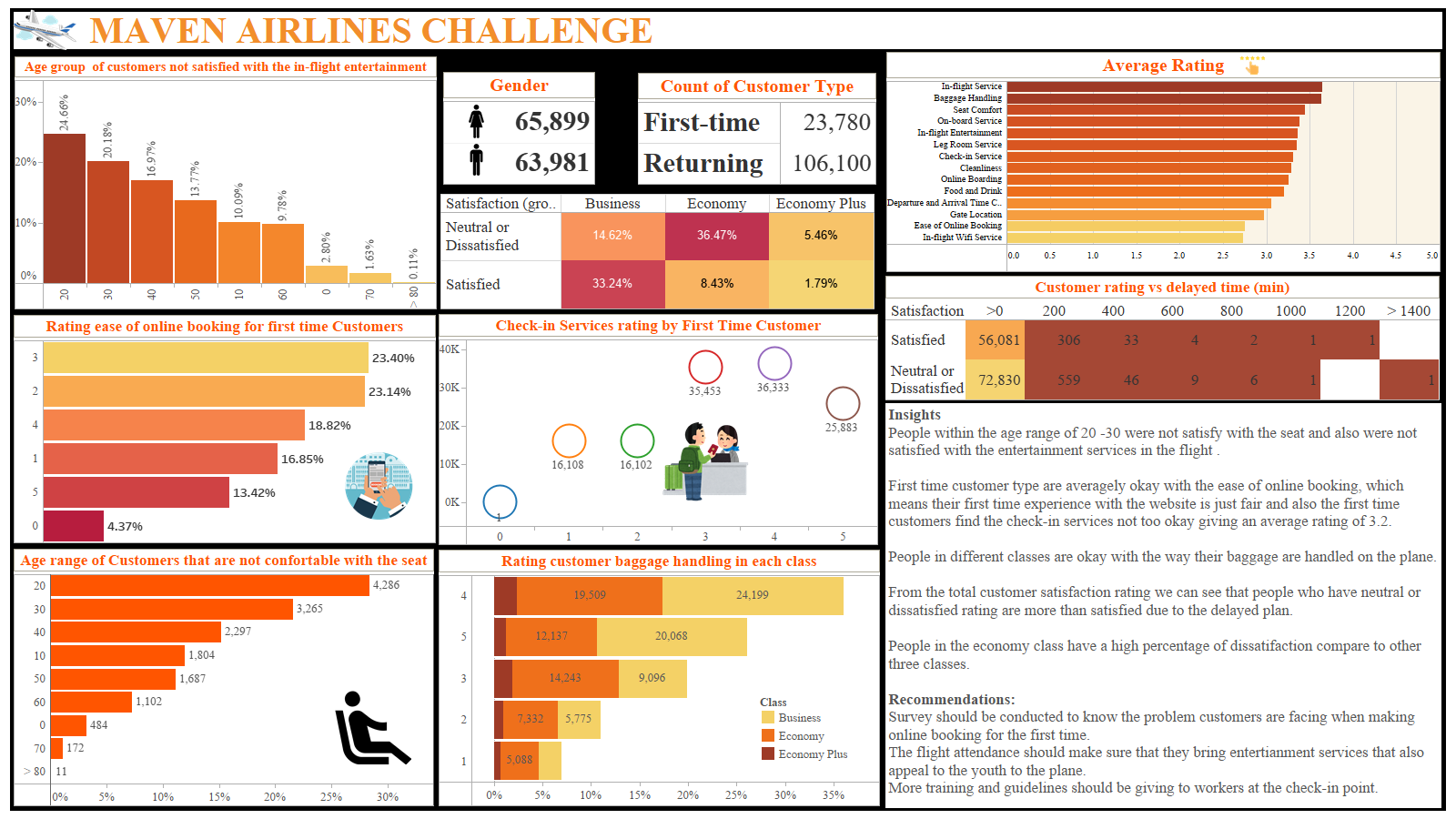
Visual report analyzing airline passenger satisfaction feedback using Tableau.
View Project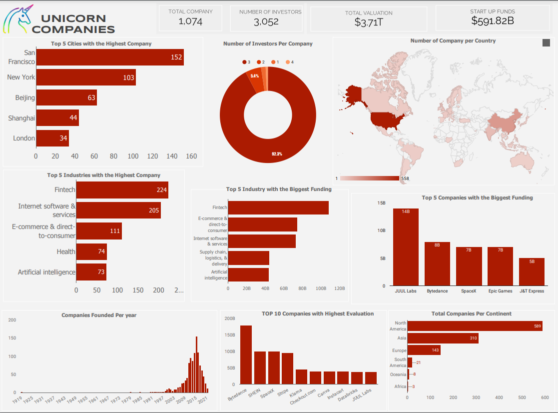
Dashboard analysis exploring and uncovering insights into Unicorn company performance metrics using Looker.
View Project